Welcome to the Cross River State GIS Users Group website.This Group is opened to anyone interested in the development of GIS in Cross River StateWebsite developed and maintained by Adewale Adegoke:GIS Expert EU/IWRM project
Need Geographical data?Need Updates for your Geographical data?Then Come on board the GIS Users group and see what the members have to offer. Click to download stakeholder analysis and membership form. Contact E mail the GIS Users Group @ crsgisusergroup@yahoo.com.Register with us and the group e mail account password will be sent to you. Search for free GIS tutorials below.e.g. 'Free GIS Tutorials' Free GIS Tutorial and Resources Click to see how GIS is used and how you can use GIS to realise your business objectives. Click for Free ESRI Canada GIS tutorials Click for Free ESRI GIS virtual campus step by step tutorials Click for Free Harvard University GIS tutorials ESRI mapping center.Ask a cartographer Click to go to the ESRI Developer Network(EDN).Learn how to customise your ArcGIS software and extend its basic functionality with free source codes and applications. How well do you understand GIS?..Need more knowledge CLICK HERE
CHECK THIS OUT.....ADD INFORMATION TO LOCATION ON WIKIMAPIA.....Really cool.
GIS News Feeds |
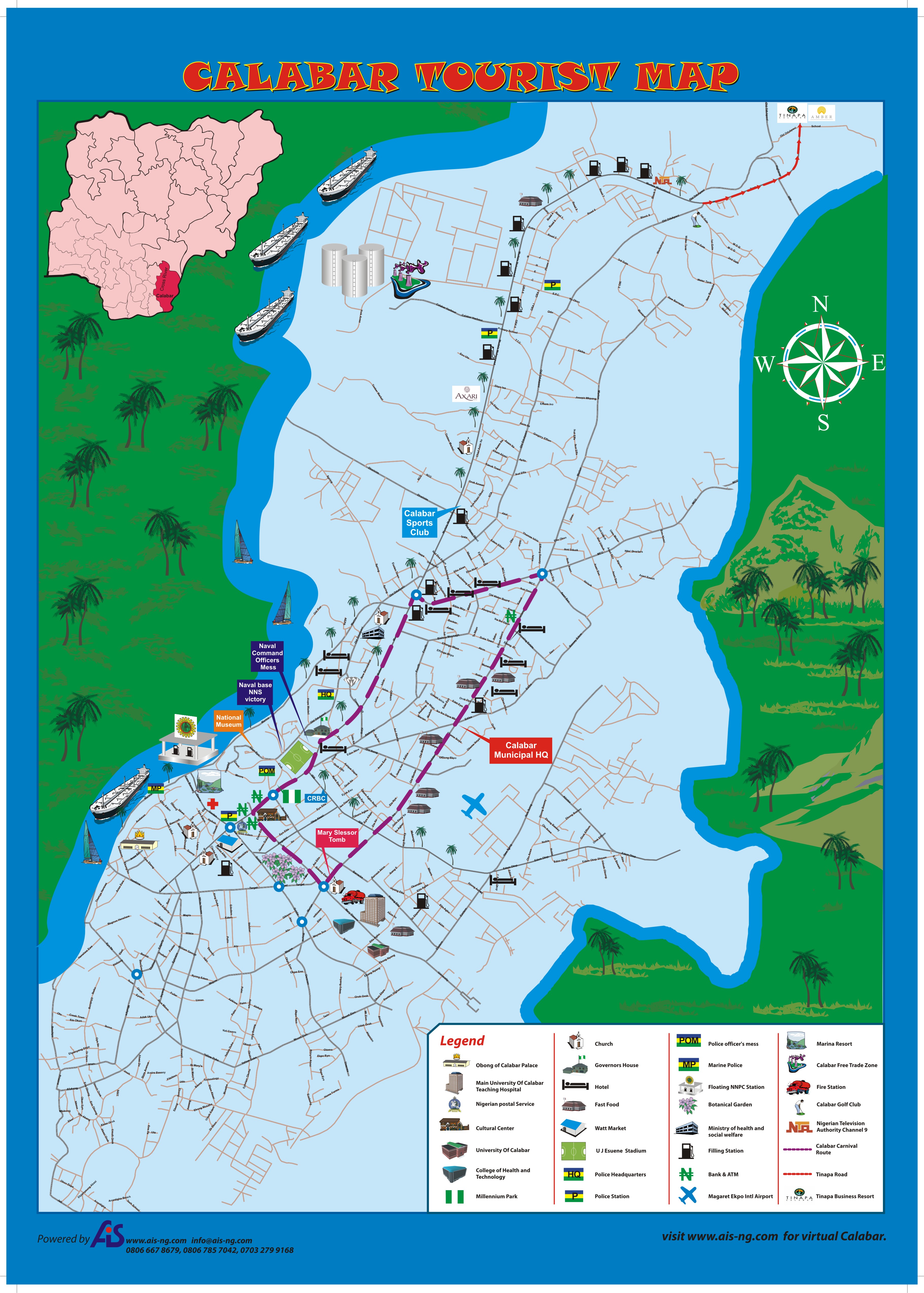
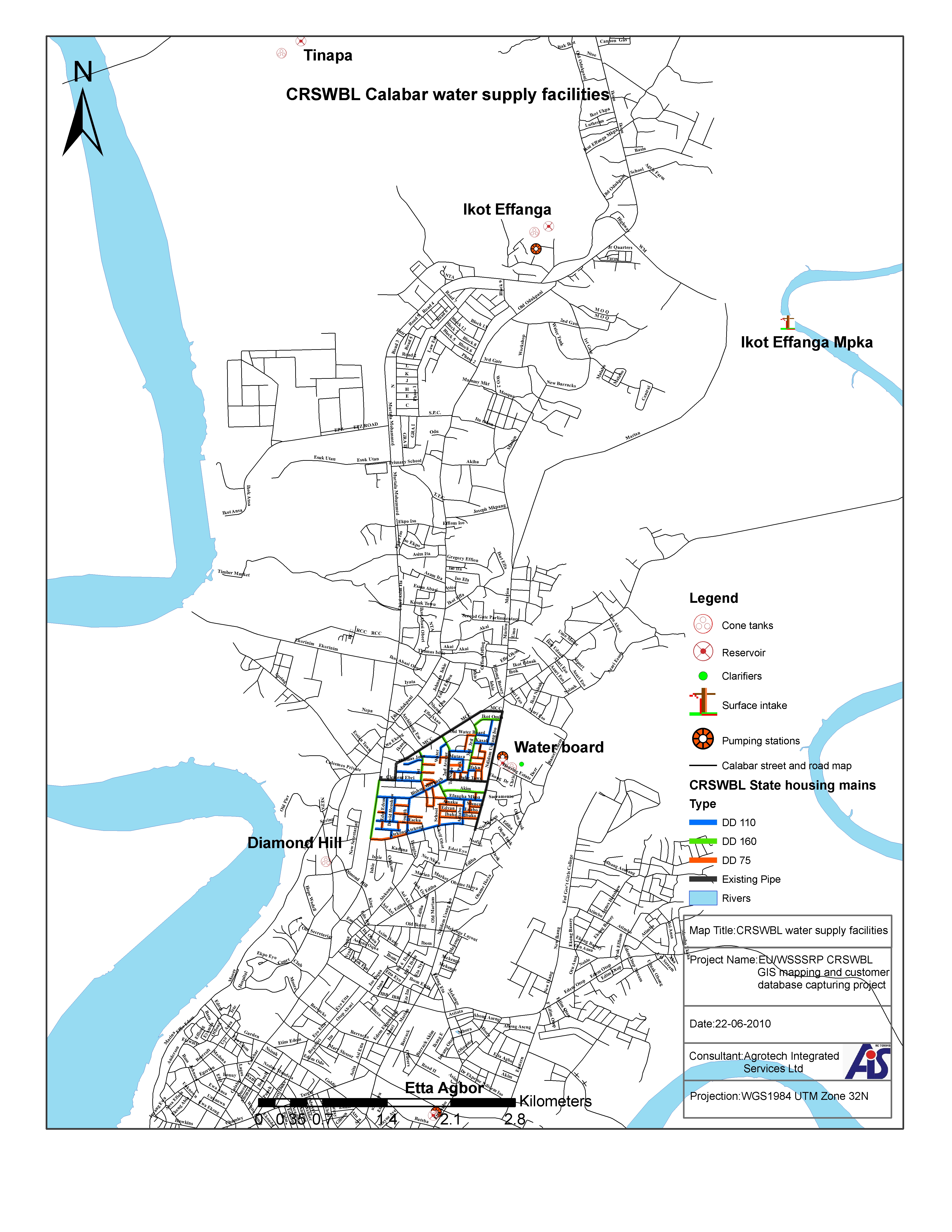
Maps below showing Calabar tourism potential on the left and water facilities on the right.
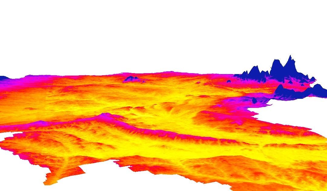
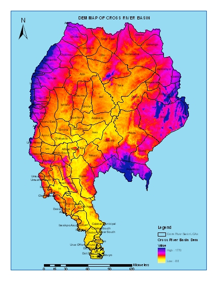
Downloads Click to download the first Calabar tourist map Click to download Calabar State housing estate water distribution facility map Click to download 3d DEM map of the Cross River Basin Click to view 3d map in VRML,actual 3d space.pls download cortona viewer here to view file. Download free ArcGIS 9x and Arcview 3.2 compatible custom scripts Click for free GIS software,plug-ins and extensions
 |
|||||||||||||||||||||||||||||||||||
Courtesy EU/IWRM project |
||||||||||||||||||||||||||||||||||||